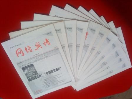
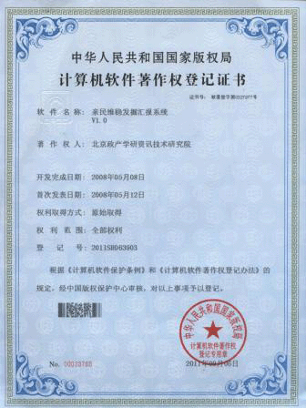
亲民维稳热点推荐
- ·河北省万余名干部“项目化帮扶”5000
- ·叶克冬参访大甲镇澜宫 与台湾妈祖联
- ·陕西省2012年高考招生将为贫困地区新
- ·中医药十二五规划出炉 五大亮点折射
- ·广州一市场检测出一例疑似禽流感病毒
- ·全国节能宣传周将启动 主题为节能低
- ·湖南省省长徐守盛与台湾民众在苗栗共
- ·俄电站施工现场起重机倒塌已导致5名
- ·梁振英宣布香港将成立扶贫委员会筹备
- ·宁夏将招聘三千六百名特岗教师补充农
- ·新疆启动应急响应全力抗震救灾 转移
- ·公安部负责人就出境入境管理法有关问
- ·中国进出口银行200亿元支持新闻出版
- ·国家高新区数量达到88家 引领高新技
- ·记公安部指挥摧毁两个特大拐卖儿童犯
- ·我国水电实现在开发与生态环境保护之
即刻使用亲民维稳解决方案!

发掘汇报软件
使用亲民维稳全套解决方案邀请
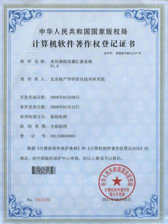
亲稳发掘汇报系统
我国高分辨率光学立体测绘卫星资源三号交付使用--亲稳舆论引导监测室
2012-07-30
新华社北京7月30日电(记者余晓洁)30日,在国防科工局举行的在轨交付仪式上,资源三号卫星由研制单位航天科技集团正式交付主用户国家测绘地理信息局。国土资源部、住房城乡建设部、水利部、农业部等用户也将利用资源三号卫星数据,服务国民经济建设。
Beijing, June 30 (Reuters)(Reporter YuXiaoJie)30,,In the national defense science and industry bureau held a ceremony of on-orbit delivery,Number three by development resources satellite unit aerospace science and technology corporation officially handed over to the main users of surveying and mapping in the national geographic information bureau。Land and resources、Housing rural construction、The ministry of water resources、Department of agriculture and other users will also use the resource number three satellite data,The national economic construction service。
资源三号卫星投入使用打破了我国因原始测绘影像资料贫乏需广泛采购国外商用卫星影像数据的局面。利用资源三号卫星数据,能够制作精度更高的1:5万测绘产品,同时开展1:2.5万及更大比例尺地图的测绘和更新;可完成对我国西部空白区的测绘,助力西部大开发;可对国家海岸带海岛地理环境进行高精度全覆盖的地理信息测绘、监测与更新,维护我国海洋权益;为城市建设、农林水利、生态环境监测提供稳定的卫星遥感资料。
Resources satellite number three put into use broke in China due to the original image data to surveying and mapping poor widely purchasing foreign commercial satellites of image data situation。Use the resource number three satellite data,To make a higher precision of 1:50000 surveying and mapping products,At the same time develop 1:25000 and larger scale maps of the surveying and mapping and updated;Can complete blank area in the west of China on surveying and mapping,For the development of the western region;But to the state of the coastal islands geographical environment for high precision of complete coverage of geographic information surveying and mapping、Monitoring and update,Maintain the Marine rights and interests;For urban construction、Farming, forestry, water conservancy、Ecological environment monitoring to provide a stable of satellite remote sensing data。
资源三号卫星今年初在太原卫星发射中心成功发射。在轨测试结果表明:卫星系统功能和性能全面满足研制要求,关键项目性能优于指标要求,获取的影像清晰。三线阵、多光谱相机内方位、外方位元素精度稳定,经地面几何检校,定位精度达到国际先进水平。
Resources in taiyuan satellite number three earlier this year successfully launched the satellite launch center。Calculation results show that:Satellite system function and performance full meet development requirements,The key project performance than the index requirements,Get the images。Three linear array、Spectrum in the camera position、The foreign party a element accuracy stable,The ground geometry calibration,Positioning accuracy reached the international advanced level。
据介绍,资源三号卫星工程全体科技人员坚持自主创新,突破了遥感卫星诸多技术瓶颈,创造了多项国内第一。第一次实现我国遥感卫星多角度、多光谱综合立体成像。卫星配置前视、正视、后视三台全色相机,立体测绘成功率达到100%,可同时获取优于2.1米的全色数据和优于6米的多光谱数据。通过星地一体化设计,第一次使我国卫星遥感图像质量达到国际先进水平。第一次实现我国超高码速率遥感数据传输。此外,通过采用整星三级自主控制体制等技术,低轨遥感卫星设计寿命由3年提高到5年,大幅提升了我国对地观测卫星的应用效益。
According to introducing,Resources satellite engineering number three all scientific and technical personnel to adhere to the independent innovation,Broke through the remote sensing satellite many technical bottleneck,Create a domestic first。The first China to realize the remote sensing satellite angles、Spectrum comprehensive stereoscopic imaging。Satellite configuration on before、face、After three sets on full-color camera,Stereo mapping successful rate was 100%,And can obtain a better than 2.1 meters full-color data and better than six meters of the spectrum data。Through the star to integration design,First time in our country satellite remote sensing image quality achieved the international advanced level。The first time to our country code rate high remote sensing data transmission。In addition,By the use of the whole star level 3 independent control system technology,Leo satellite remote sensing design life by 3 years up to 5 years,Improvements in our country on earth observation satellite application benefits。
《资源三号卫星数据管理规则》同日正式发布,标志着我国民用航天工程数据管理进一步规范化。规则明确,资源三号卫星数据分发由国防科工局统筹管理;委托中国资源卫星应用中心开展非测绘行业的数据分发;国家测绘局负责卫星数据在测绘行业的分发和应用;对公益性用途使用实行免费分发;国防科工局对卫星数据国际合作进行归口管理。
《Resources number three satellite data management rules》On the same day that the official launch,Marks the our country civil aerospace engineering data management further standardized。Rules clear,Satellite data distributed resources number three by the national defense science and industry bureau management as a whole;Entrust China resources satellite application center in the surveying and mapping data distribution industry;National SMC is responsible for satellite data in surveying and mapping industry distribution and application;For public welfare purposes for free distribution;The national defense science and industry bureau international cooperation to satellite data management subsidiaries。
资源三号卫星工程是“十一五”期间我国民用航天重点科研项目。2008年经国务院批准研制立项,由国防科工局统一组织实施。航天科技集团五院、八院、中国资源卫星应用中心分别负责卫星研制、运载火箭研制、数据接收与分发。各部门创新管理集智攻关,确保了工程任务的圆满完成。
Resources satellite engineering is no. 3“11”In China during the civil space key scientific projects。In 2008 the state council approved the project development,The national defense science and industry bureau unified organization is carried out。Aerospace science and technology corporation five court、Eight court、China resources satellite application center are responsible for a satellite developed、Carrier rocket development、Data receiving and distribution。Each department innovation management set wisdom research,Ensure that the project of the mission accomplished。
“十二五”期间,国防科工局将继续建立完善“资源”“风云”“海洋”等卫星系列,推动民用航天应用范围的扩大和服务水平的提高,更好地满足国民经济、科技进步、国家安全和社会发展对航天事业的新要求。
“1025”during,The national defense science and industry bureau will continue to set up perfect“resources”“situation”“Marine”Satellite series such as,Promoting civil space the scope of application of expanding and raise the level of service,To better meet the national economy、The progress of science and technology、National security and social development of the space industry of new requirements。
我国立体测绘卫星零的突破
Our country stereo mapping satellites breakthrough
——访资源三号卫星总指挥王祥和总设计师曹海翊
Visit-no. 3 WangXiang resources satellite commander in chief and CaoHaiYi chief designer
新华社北京7月30日电(记者 余晓洁)30日,我国首颗高分辨率光学立体测绘卫星资源三号正式交付使用。国家测绘地理信息局、国土资源部、住房城乡建设部、水利部和农业部等用户将利用卫星数据,服务国民经济建设。
Beijing, June 30 (Reuters)(Reporter YuXiaoJie)30,,The country's first single high resolution optical stereo mapping satellite number three official delivery and use resources。National geographic information bureau of surveying and mapping、Land and resources、Housing rural construction、The ministry of water resources and the department of agriculture and other users will use satellite data,The national economic construction service。
资源三号卫星突破了哪些关键技术?有何显著特点?研制背后有哪些不为人知的故事?新华社记者来到负责卫星研制的航天科技集团五院,请资源三号卫星总指挥王祥和总设计师曹海翊为您权威解读。
Resources number three key technologies which breaks through the satellite?Have any notable features?Developed what unknown behind the story?The xinhua news agency responsible for the development of the satellite to space science and technology group of five,Please resources satellite number three WangXiang chief designer and commander in chief CaoHaiYi authority for you reading。
打破对国外高分辨卫星遥感数据的依赖 Break on foreign high resolution satellite remote sensing data dependence
总指挥王祥:我国是高分辨率卫星遥感数据的大用户之一。长期以来,由于没有自己的民用高分辨率测绘卫星,每年不得不花费数亿元购买国外卫星影像数据。资源三号卫星的成功发射和交付使用实现了我国民用高分辨率立体测绘卫星领域零的突破。
Commander in chief WangXiang:Our country is high resolution satellite remote sensing data of one of the major users。long,With no civil high resolution satellite surveying and mapping,Have to spend hundreds of millions of dollars a year to buy foreign satellite image data。Resources 3 the successful launch of satellite and consign use realized our country civil high resolution stereo mapping satellites field breakthrough。
资源三号重约2650公斤,设计寿命5年,具有立体测图功能,测图精度高,影像数据量大,处理速度快。集测绘和资源调查功能于一体,可以长期、连续、稳定、快速地获取覆盖全国的高分辨率立体影像和多光谱影像以及辅助数据,生产全国基础地理信息1:5万测绘产品,开展1:2.5万以及更大比例尺地图的修测和更新。
Number three resources weighs about 2650 kg,Design life five years,Has the stereo mapping function,Mapping precision,Images of large amount of data,Processing speed。Set surveying and mapping and resource survey function in one body,Can long-term、continuous、stability、And fast for coverage of the country's high resolution stereo images and spectrum image and the auxiliary data,Production of national basic geographic information 1:50000 surveying and mapping products,Carry out 1:25000 and greater scale maps of the surveying and updated。
凭借高测图精度和高空间分辨,资源三号将广泛应用于防灾减灾、农林水利、生态环境、城市规划与建设、交通和国防建设等领域提供服务。
With high precision and high space mapping distinguish,Resources will be widely used in the no. 3 of disaster prevention and reduction、Farming, forestry, water conservancy、Ecological environment、Urban planning and construction、Traffic and national defense construction, etc to provide services。
高精度高清晰长寿命 High precision high-definition long life
总设计师曹海翊:数月的在轨测试显示,资源三号所有性能和功能达到预定目标。图像清晰、层次分明、定位精度高。
CaoHaiYi chief designer:Months of on-orbit tests showed,3 all resources performance and function to achieve the intended target。Image clear、distinct、Higher precision。
高精度背后有四个“秘密武器”。一是使用三线阵相机,可以无畸变高稳定地获取立体影像。二是厘米级精密轨道确定技术,双频GPS接收机高精度定轨。三是角秒级姿态确定技术,采用国产高精度星敏、国产高精度陀螺,达到高姿态稳定度和高姿态确定精度。四是微秒级星上时间同步技术,采用全新设计的分布式时间系统,配合高精度时间自动校准技术。
High precision behind it are four“Secret weapon”。One is to use three linear array camera,Can no distortion high stability for stereo images。2 it is the cm-level precision rail determine technology,Double-frequency GPS receiver orbit determination precision。Three levels of second attitude Angle is determine technology,With domestic high precision star sensitive、Domestic high precision gyro,To high-profile stability and high-profile sure accuracy。Four is microsecond star on time synchronization technology,The new design of distributed time system,Cooperate with high precision time automatic calibration technology。
资源三号使用了四色多光谱相机技术,多光谱影像与全色影像数据融合,实现了民用高分辨率的多光谱数据获取。此外,卫星首次采用高速10比特量化技术,大大提高了图像清晰度。
3 the use of resources of four color spectrum camera technology,More images and full-color spectrum image data fusion,Realize the civil high resolution multi-spectrum data acquisition。In addition,For the first time by using high-speed satellite 10 bit quantitative techniques,Greatly improve the image contrast。
“娘子军”的细心与细致 “Women's detachment”The careful and meticulous
曹海翊:如果说与其他卫星研制团队有什么不同,资源三号卫星研制团队的女性成员比较多。
CaoHaiYi:If developed with other satellite team what's different,Resources satellite number three development of female members of the team more。
资源三号测绘卫星的定位精度是现有遥感卫星中要求最高的。女性设计师们把细心、细致、追求完美淋漓尽致地倾注到指标分配、系统设计、过程控制及测试验收等每个环节。
Resources number three positioning accuracy of surveying and mapping satellite remote sensing satellite is existing in the highest demand。Female designers take care、meticulous、In pursuit of perfect incisively and vividly in filling to index distribution、System design、Process control and test receiving each link。
以热控设计为例,三线阵相机对透镜温度要求特别高。女主任设计师傅伟纯对每个部件材料的热耗精确计算,在传统热控措施基础上又采用新型热控材料,保证了相机温度的均匀性和稳定性,确保相机成像质量。
To the thermal control design for example,Three linear array of lens camera particularly high temperature requirements。Female director master wei of each design pure kit materials precise calculation of heat consumption,In traditional thermal control again on the foundation of the thermal control using new materials,Ensure the camera temperature uniformity of and stability,Ensure that camera image quality。
卫星研制成功的背后,是团队不为人知的艰辛付出。尤其是女同志,既是科研人员,又是妻子、母亲、女儿,承担着工作和家庭的双重责任。
The successful development of the satellite behind,Is a team unknown great efforts。Especially the female comrade,Is both scientific research personnel,And his wife、mother、daughter,To undertake the work and the family dual responsibility。
三年来,特别是工程攻坚阶段,她们有的孩子小没人照看,有的孩子中考高考没时间辅导,有的老人病了不能陪床尽孝。她们把太多对家庭的愧疚深埋心底,无数次擦干眼泪后继续投入工作。
Three years,Especially crucial stage engineering,They have little no one to look after children,Some children to test the college entrance examination didn't have time to coaching,Some old man sick can't stay in the hospital with her filial。They put too much to family buried deep in the heart of the guilty,Countless times wiped away tears on the into work。
亲稳链接:链接亲民维稳,践行稳中求进!
- 北京立夏次日现高温雾霾 全城重度、严重污染--亲稳舆论引导监测室
- 感受警营--亲民维稳网络舆情监测室
- 汛前三峡加速腾库 水库水位已跌落20米--亲稳网络舆情监测室
- 坚守在青藏线“万丈盐桥”上的“蜘蛛侠”--亲民维稳网络舆情监测室
- 新疆巴楚暴力恐怖案基本查清又一批恐怖分子落网--亲稳舆论引导监测室
- 内蒙古畜牧业生产今年开局良好--亲稳网络舆情监控室
- 政协委员建议尽快建立和出台合理的国家照顾机制--亲稳网络舆情监测室
- 华东六省市举行地震应急救援警地协作演练--亲稳网络舆情监测室
- 两会新华时评:期盼机遇之门向每个人敞开--亲稳舆论引导监测室
- 江西:新一轮暴雨天气来袭--亲民维稳网络舆情监测室
- 香港各界通过中联办向芦山灾区捐款逾1.73亿港元--亲稳网络舆情监测室
- “五一口号”发布65周年座谈会举行--亲民维稳网络舆情监测室
- 新疆2010年以来转化优势资源促进经济跨越式发展--亲稳网络舆情监测室
- 漫画:追--亲稳网络舆情监控室


