


亲民维稳热点推荐
- ・河北省万余名干部“项目化帮扶”5000
- ・叶克冬参访大甲镇澜宫 与台湾妈祖联
- ・陕西省2012年高考招生将为贫困地区新
- ・中医药十二五规划出炉 五大亮点折射
- ・广州一市场检测出一例疑似禽流感病毒
- ・全国节能宣传周将启动 主题为节能低
- ・湖南省省长徐守盛与台湾民众在苗栗共
- ・俄电站施工现场起重机倒塌已导致5名
- ・梁振英宣布香港将成立扶贫委员会筹备
- ・宁夏将招聘三千六百名特岗教师补充农
- ・新疆启动应急响应全力抗震救灾 转移
- ・公安部负责人就出境入境管理法有关问
- ・中国进出口银行200亿元支持新闻出版
- ・国家高新区数量达到88家 引领高新技
- ・记公安部指挥摧毁两个特大拐卖儿童犯
- ・我国水电实现在开发与生态环境保护之

即刻使用亲民维稳解决方案!

发掘汇报软件


使用亲民维稳全套解决方案邀请
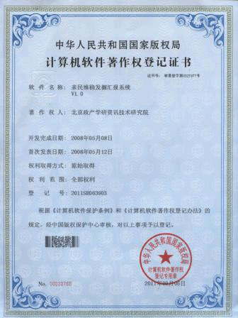
亲稳发掘汇报系统
交通运输部:长江电子航道图成功实现系统升级--亲稳网络舆情监控室
2012-08-24
新华社武汉8月24日电(记者 田建军)记者从交通运输部长江航道管理局获悉,贯通长江2000多公里干线航道的长江电子航道图(2.0版)近日圆满研发制作完成,成功实现系统升级,这意味着我国长江“数字航道”和“智能航道”建设迈上了一个新台阶。
Xinhua news agency on August 24, wuhan(Reporter y)Reporters from the traffic department of transportation the Yangtze river waterway bureau,Through the Yangtze river 2000 kilometers main channel of the Yangtze river electronic navigation channel chart(Version 2.0)Recently a complete research and development production,The successful implementation system upgrade,This means that our country Yangtze river“Digital channel”and“Intelligent channel”Step on the construction of a new stage。
所谓“电子航道图”,通俗地讲就是传统纸质航道图的数字化,以数字化形式直观准确地展现长江及两岸地物要素的数字地图产品。近年来,随着长江水运的飞速发展,传统的纸质航行参考图由于更新周期长,航道、航标信息不能及时有效更新,已不能完全满足船舶航行要求。长江电子航道图通过数字化形式及时更新,为长江上的行轮提供准确的助航标志、水深数据、地物地貌等航行信息,设计最佳航线并保证其安全航行。
The so-called“Electronic navigation channel chart”,Generally speaking is the traditional paper channel map digitization,In digital form intuitive accurately show the Yangtze river and the feature elements of the digital map products。In recent years,With the rapid development of the Yangtze river water transportation,The traditional paper navigation reference due to update cycle is long,channel、Beacon information can't timely and effective update,Have been unable to fully meet the requirements of ship navigation。The Yangtze river electronic navigation channel chart through the digital form update,For the Yangtze river on the road wheel provide accurate navigation marks、Depth data、Physiognomy and navigation information,The optimal design of the route and guarantee the safe navigation。
长江电子航道图的研制始于2007年,2008年我国第一段数字航道――全长369.5公里的长江下游南(京)浏(河口)段数字航道全面建成并投入使用,2009年长江干线2687.8公里航道的电子航道图全线贯通,2011年12月22日正式投入使用。
The Yangtze river electronic navigation channel chart research began in 2007,In 2008, the first paragraph digital channel - 369.5 km south of the Yangtze river downstream(Beijing)clear(estuary)Period of digital waterway comprehensive built and put into use,In 2009, the Yangtze river main 2687.8 kilometers waterway electronic channel map all through,On December 22, 2011 formally put into use。
据长江航道局局长熊学斌介绍,长江电子航道图(2.0版)是对此前已经投入使用半年多的长江电子航道图的一次系统升级,共涉及产品文件416幅,其中全线索引图9幅,水道详情图344幅,整个航道图的生产制作历时7个月时间。
According to the Yangtze river hydrographic department director XiongXueBin is introduced,The Yangtze river electronic navigation channel chart(Version 2.0)Is to have already been put into use after more than half a year of the Yangtze river electronic navigation channel chart a system upgrade,A total of 416 pictures in product documentation,The index of all figure 9,Channel details diagram 344 picture,The whole channel map production lasted seven months time。
熊学斌说,长江电子航道图具有国际通用性强、定位精度高、航道信息内容丰富等特点,具备自动识别与定位、导航与辅助决策、自动匹配与显示应用、航道信息动态查询与显示和航行报警提示等五大功能。长江电子航道图(2.0版)的研制成功,进一步提高了长江黄金水道的科技含量和内河航运信息化水平。
XiongXueBin said,The Yangtze river electronic navigation channel chart with international universality、Positioning accuracy high、Channel information rich content etc,Possesses automatic identification and positioning、Navigation and auxiliary decision-making、Automatic matching and display application、Channel information dynamic query and display and navigation alarm prompt five functions, etc。The Yangtze river electronic navigation channel chart(Version 2.0)The successful development of,Further improve the technological content of the gold waterway of the changjiang river and inland waterway informationization level。
据悉,长江电子航道图(2.0版)将于10月1日正式投入试运行。
It is reported,The Yangtze river electronic navigation channel chart(Version 2.0)Will be held on October 1, officially put into operation。
亲稳链接:链接亲民维稳,践行稳中求进!
- 北京立夏次日现高温雾霾 全城重度、严重污染--亲稳舆论引导监测室
- 感受警营--亲民维稳网络舆情监测室
- 汛前三峡加速腾库 水库水位已跌落20米--亲稳网络舆情监测室
- 坚守在青藏线“万丈盐桥”上的“蜘蛛侠”--亲民维稳网络舆情监测室
- 新疆巴楚暴力恐怖案基本查清又一批恐怖分子落网--亲稳舆论引导监测室
- 内蒙古畜牧业生产今年开局良好--亲稳网络舆情监控室
- 政协委员建议尽快建立和出台合理的国家照顾机制--亲稳网络舆情监测室
- 华东六省市举行地震应急救援警地协作演练--亲稳网络舆情监测室
- 两会新华时评:期盼机遇之门向每个人敞开--亲稳舆论引导监测室
- 江西:新一轮暴雨天气来袭--亲民维稳网络舆情监测室
- 香港各界通过中联办向芦山灾区捐款逾1.73亿港元--亲稳网络舆情监测室
- “五一口号”发布65周年座谈会举行--亲民维稳网络舆情监测室
- 新疆2010年以来转化优势资源促进经济跨越式发展--亲稳网络舆情监测室
- 漫画:追--亲稳网络舆情监控室