


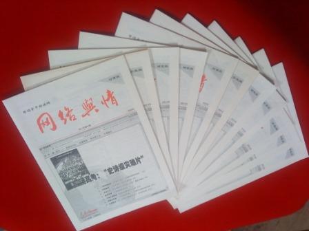
亲民维稳热点推荐
- ・河北省万余名干部“项目化帮扶”5000
- ・叶克冬参访大甲镇澜宫 与台湾妈祖联
- ・陕西省2012年高考招生将为贫困地区新
- ・中医药十二五规划出炉 五大亮点折射
- ・广州一市场检测出一例疑似禽流感病毒
- ・全国节能宣传周将启动 主题为节能低
- ・湖南省省长徐守盛与台湾民众在苗栗共
- ・俄电站施工现场起重机倒塌已导致5名
- ・梁振英宣布香港将成立扶贫委员会筹备
- ・宁夏将招聘三千六百名特岗教师补充农
- ・新疆启动应急响应全力抗震救灾 转移
- ・公安部负责人就出境入境管理法有关问
- ・中国进出口银行200亿元支持新闻出版
- ・国家高新区数量达到88家 引领高新技
- ・记公安部指挥摧毁两个特大拐卖儿童犯
- ・我国水电实现在开发与生态环境保护之

即刻使用亲民维稳解决方案!

发掘汇报软件

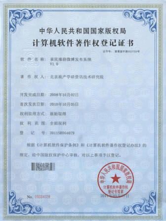
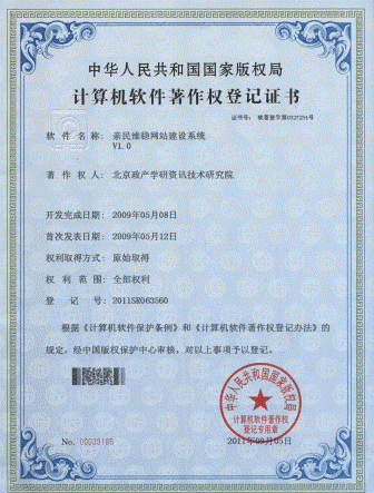
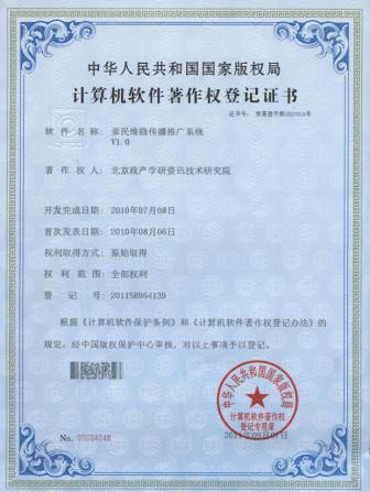


使用亲民维稳全套解决方案邀请
亲稳发掘汇报系统
长江航运“GPS”技术正起步--亲民维稳网络舆情监测室
2012-12-19

12月18日,一艘船舶的驾驶员在驾驶舱内参考长江电子航道图(2.0版)在水雾弥漫的长江航道重庆段水域上航行。桥区预报、航路调整、可航水深、航向以及航速……日前,随着长江电子航道图(2.0版)在渝投入试运行,长江航运电子地图替代传统纸质航行参考图的“数字航运”技术起步发展。安装长江电子航道图(2.0版)的船舶,如同安装了“GPS导航”的汽车一样,系统会实时监测长江“路况”随时提醒,为长江上的行轮提供准确的助航标志、水深数据、地物地貌等航行信息,设计最佳航线并保证其安全航行。长江电子航道图的研制始于2007年;2008年,我国第一段数字航道――全长369.5公里的长江下游南(京)浏(河口)段数字航道全面完成并投入使用;2009年,长江干线2687.8公里航道的电子航道图全线贯通;2011年12月22日,长江电子航道图(1.0版)正式投入试用。新华社记者 刘潺 摄 12 months and days,A ship driver in the cockpit of the Yangtze river waterway reference electronic map(Version 2.0)In the water mist diffuse the Yangtze river waterway chongqing section water on navigation.Flyover forecast/Route adjustment/Navigable water depth/Course and speed...a,As the Yangtze river electronic channel map(Version 2.0)Put into operation in chongqing,The Yangtze river shipping electronic map is used to replace the traditional paper navigation reference map"Digital shipping"Technology development started.Install the Yangtze river electronic channel map(Version 2.0)ship,As the installation"GPS navigation"Car as,The system can real-time monitor the Yangtze river"traffic"Keep reminding,For the Yangtze river on the road wheel provide accurate navigation mark/Depth data/Physiognomy and navigation information,The optimal design of the route and guarantee the safe navigation.The Yangtze river electronic channel map development began in 2007;In 2008,,China's first period of digital channel - 369.5 km south of the Yangtze river downstream(Beijing)clear(estuary)Period of digital channel completed and put into use;In 2009,,The Yangtze river main 2687.8 kilometers waterway electronic channel map all through;On December 22, 2011,The Yangtze river electronic channel map(Version 1.0)Formally put into trial.Xinhua news agency reporter liu Chan perturbation

12月18日,长江朝天门航道寸滩班组的工作人员操作着专业GPS设备,在岸边测量点测量当日的水位数据,为长江电子航道图(2.0版)提供数据更新。新华社记者 刘潺 摄 12 months and days,The Yangtze river ChaoTianMen channel "beach team staff operating the professional GPS equipment,On the shore measuring point measuring the water level of the data,For the Yangtze river electronic channel map(Version 2.0)Provide data update.Xinhua news agency reporter liu Chan perturbation

这是船舶上的接收终端显示的实时航道电子地图(12月18日摄)。新华社记者 刘潺 摄 This is the ship on the receiving end of the display real-time navigation electronic map(December and perturbation,).Xinhua news agency reporter liu Chan perturbation
亲稳链接:链接亲民维稳,践行稳中求进!
- 北京立夏次日现高温雾霾 全城重度、严重污染--亲稳舆论引导监测室
- 感受警营--亲民维稳网络舆情监测室
- 汛前三峡加速腾库 水库水位已跌落20米--亲稳网络舆情监测室
- 坚守在青藏线“万丈盐桥”上的“蜘蛛侠”--亲民维稳网络舆情监测室
- 新疆巴楚暴力恐怖案基本查清又一批恐怖分子落网--亲稳舆论引导监测室
- 内蒙古畜牧业生产今年开局良好--亲稳网络舆情监控室
- 政协委员建议尽快建立和出台合理的国家照顾机制--亲稳网络舆情监测室
- 华东六省市举行地震应急救援警地协作演练--亲稳网络舆情监测室
- 两会新华时评:期盼机遇之门向每个人敞开--亲稳舆论引导监测室
- 江西:新一轮暴雨天气来袭--亲民维稳网络舆情监测室
- 香港各界通过中联办向芦山灾区捐款逾1.73亿港元--亲稳网络舆情监测室
- “五一口号”发布65周年座谈会举行--亲民维稳网络舆情监测室
- 新疆2010年以来转化优势资源促进经济跨越式发展--亲稳网络舆情监测室
- 漫画:追--亲稳网络舆情监控室