亲民维稳热点推荐
- ·上海民办教育系列探索 扶持中规范--
- ·学校建好却被闲置 广州楼盘公校为何
- ·选专业痴心不改不服调剂 湖北23名高
- ·“高考阅卷师冒死揭露内幕”系“旧帖
- ·武警八年守卫考试院 见证高考录取变
- ·衔接班暑假升温 “影子教育”盛行的
- ·高考贫困学子:通往目标的路,不止一
- ·中国青年报:公务员是纳税人供养的--
- ·校车过渡期不让学生无车可乘--亲民维
- ·河南高校录取通知书被强迫改EMS快递-
- ·教育部部署2012年庆祝教师节活动安排
- ·乡村教师走出大山 意外实现“大学梦
- ·云南教育厅厅长罗崇敏卸任演讲:我改
- ·看民国语文教材:甄嬛体还教戒赌存钱
- ·这个暑假留守儿童不孤单--亲民维稳网
- ·小一新生个性足 开学首日和老师“提
即刻使用亲民维稳解决方案!

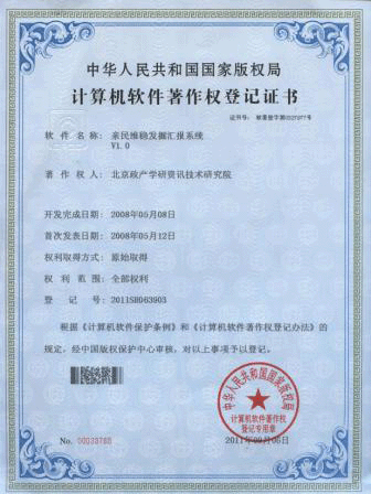
发掘汇报软件
使用亲民维稳全套解决方案邀请
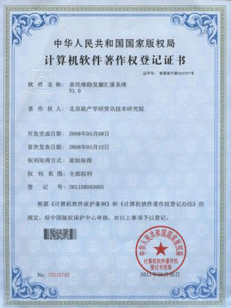
亲稳发掘汇报系统
中国夜景卫星图疯传 最亮地方被调侃学生上自习--亲稳网络舆情监控室
2012-11-05
 网传的中国夜景卫星图
The network of Chinese night scene satellite imagery
昨天,一张“卫星拍摄最新中国夜景图”走红网络,北京、山东、江浙等地在夜里灯光集中,十分耀眼,而江苏、山东也成了网友们调侃的热点,戏称两省大亮全因“学生刚刚开始上晚自习”。但记者经过细心比对发现,这张图和去年8月美国国家海洋和大气管理局发布的一组卫星图像非常相似,而且这组图也是用来研究灯光使用情况的。
yesterday,a"Satellite pictures latest China night scene graph"Popular network,Beijing/shandong/The jiangsu and zhejiang provinces, etc in the night light concentration,Very bright,And jiangsu/Shandong has become the focus of the net friend ridicule,Calls the two provinces light enough for all"Students just started at wanzi xi".But reporters found that after careful comparison,This picture and last August the national oceanic and atmospheric administration issued a set of satellite image are very similar,And this map is also used to study of the use of light.
中国夜景卫星图 China's nocturne satellite imagery
江苏亮瞎了 Jiangsu bright blind
昨天不少媒体官方微博转发这张“卫星拍摄最新中国夜景图”,还附带一句“江苏的学生刚刚开始上晚自习”,而图中江苏的确比其他地方都要“亮”得多。据网友描述,这个“夜景图”其实是卫星拍摄的“夜间灯光分布图”,虽然黑乎乎一片,但依然能从图上浅灰色的轮廓线轻松看出是中国的地图。里面包括了我国大部分省市,除了人烟稀少的西南地区外,剩余区域都被许多亮点占领,沿海一些城市的光点因为太过密集,连成了大块圆点状,而中部的小光点则连成了网。北京、山东、江苏、四川、广东等人口密集的省市都被大片的光点覆盖,而江浙沪交集处的灯光最为闪亮,其中江苏的“贡献”最大,密集的灯光甚至从苏南绵延到了苏中地区,都是一整片的光带,引来众多网友感叹:“江苏真是亮瞎了!”
Yesterday a lot of media official micro bo forwarding this picture"Satellite pictures latest China night scene graph",Also attached a"Jiangsu students just started at wanzi xi",In the figure and jiangsu indeed than any other place to"bright"than.According to the net friend describe,this"Night scene graph"Is actually the satellite pictures"Night lighting profile",Although the dark, a piece of,But can still from the chart grayish contour line is easily see a map of China.It includes the majority of provinces and cities in our country,In addition to the sparsely populated southwest external,Residual area are many window occupation,Coastal some of the city's spot because it was too dense,Connect the large circle point,Central and small spot, connect to the Internet.Beijing/shandong/jiangsu/sichuan/Guangdong provinces and cities populated by large spot coverage,And with the lights of the jiangsu in the most shining,The jiangsu"contribution"maximum,The lights of the dense even from southern jiangsu stretch to the middle area,Is a whole piece of light band,Draw many users exclamation:"Jiangsu is really bright blind!"
“全国教育看江苏”这句话在互联网上经久不衰,再加上各种升学考试中被奉为“神级”的山东学生,这张“夜景图”又被网友们赋予了新含义,众多转发这张图的网友都会跟着附带一句“江苏的学生刚上晚自习”或者“山东的学生还没有下晚自习”,来解释两省的灯特别亮的“真相”。
"The national education see jiangsu"This sentence in the Internet enduring,Add all kinds of entrance tests was made"God level"Shandong students,This piece of"Night scene graph"Was the netizens endowed with new meanings,Many forwarding this picture with a net friend will follow"Jiangsu students just at wanzi xi"or"Shandong students haven't arching over under",To explain the provinces of lamp special bright"truth".
虽然调侃江苏学生“挑灯夜读”的网友很多,但也有不少网友猜测,江苏如此之亮,也与其丰富的夜生活以及亮化工程有关。拿南京来说,“南京治安不错,肯定也和晚上路灯比较多有关”,网友“驻山”说。另外网友们也发现,“夜景图”中几处明显很亮的地方都是人口密集的大城市,“人多自然用的灯也多,想像一下每盏灯后面都会有一个玩电脑的,更亮了”。
Although poking fun at jiangsu students"Stay over night"Net friend of many,But there are not a few net friend guess,Jiangsu so bright,Also with rich nightlife and lighting engineering related.Take for nanjing,"Nanjing security good,Must have and evening lamps more relevant",Net friend"In mountain"said.In addition the netizens also found,"Night scene graph"Several significant in very bright place are large city with a dense population,"Many natural light also many,Imagine each lamp behind will have a play computer,More bright".
美国空军拍摄的卫星图 The U.S. air force shooting satellite map
研究人类电灯使用情况 The study of human lamp use condition
昨日,现代快报记者在美国国家海洋和大气管理局(NOAA)的官方网站上找到一组“世界可再生能源和灯光”卫星图,也就是网上流传的“中国夜景卫星图”的原图。这组图来自美国空军的国防气象卫星拍摄的数据,它在夜间捕捉能源和灯光的能力被NOAA赞为“独一无二”。这组图包括了世界上所有的国家,是NOAA在2011年8月发布的,主要用来展示从1992年到2009年这17年中,人类在夜间使用电灯的变化情况。
yesterday,Modern express reporter in the national oceanic and atmospheric administration(NOAA)Web site to find a group of"The world renewable energy and light"Satellite map,Is also the popular online"China's nocturne satellite imagery"The original copy of the.This atlas from the United States air force defense meteorological satellite pictures of the data,It in the night capture energy and light ability is NOAA acclaimed"unique".This group includes of all the world's countries,NOAA is in August 2011 the release,Mainly used to display from 1992 to 2009 this 17 years,Humans use at night and the change of the electric light.
NOAA分析认为,发展中国家的用灯量和GDP挂钩,对于中国这部分的卫星图,NOAA则介绍说:“(在这17年里)中国的用灯量增长了两倍多,而GDP却增长了4倍。”亲稳链接:链接亲民维稳,践行稳中求进!
- 大学女生在宿舍养狗被保安打死 学校称气味刺鼻--亲民维稳网络舆情监测室
- 南方科大自主招生将加大向农村中学倾斜力度--亲稳网络舆情监控室
- 北京航空航天大学2013年考研成绩开通查询--亲民维稳网络舆情监测室
- 杨亚军:孩子,临时工母亲真的让你很丢脸?--亲稳舆论引导监测室
- 男孩在海滩被潮水卷走 12人组“人链”施救(图)--亲民维稳网络舆情监测室
- 安徽一岗位招公务员12人报名11人得0分--亲稳舆论引导监测室
- 波兰13岁男童开养父房车出走 独行近千公里欲寻亲人--亲稳网络舆情监控室
- 中科大少年班成立35年 院长强调学员不是神童--亲稳网络舆情监测室
- 英报发布世界大学声誉排行榜--亲稳网络舆情监控室
- 上海理工大学原校长许晓鸣涉嫌受贿案开审--亲稳舆论引导监测室
- 车辆川流不息幼童坐路边哭泣 外出要拉住娃--亲稳网络舆情监测室
- 山东烟台将规定幼儿园不得借特色班额外收费--亲稳舆论引导监测室
- 新东方CFO:未来将关闭15——25个教学中心--亲稳舆论引导监测室
- 武大大学生推出高校挂科率排行榜 中科大居首位--亲稳舆论引导监测室


